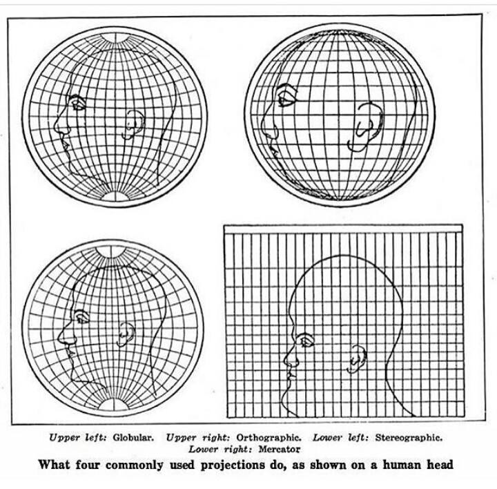
All 2D projections are distorted, but some are useful in certain contexts (yes, even Mercator, though not for viewing the entire globe at once). Google Earth is still projecting the image of a globe onto a 2D screen, and there are distortions.
Here’s South America straight on in Google Map’s globe view:
And South America from the side:
If you measure the distances between, say, Manaus and La Paz with your fingers in these pictures, you’ll get different answers. That’s just how translating a 3D object to a 2D image works; you can’t flatten a globe into a piece of paper without breaking something.
Thank you for illustrating for me. I understand what you’re saying.