You like Isaac Asimov, XML, and shoes with toes. You think the Segway got a bad rap. You own 3D goggles, which you use to view rotating models of better 3D goggles. You type in Dvorak.
Funnily enough, I typed in Dvorak for years before I ever selected Dymaxion on that comic, but I have never viewed VR goggles in VR (my first 3d goggles were in the Pentium-1-with-small-hundreds-of-MHz-of-clock era)
I needed a Trinitron monitor to get 60hz refresh in each eye
My point is Alaska is 1/5 of the USA’s landmass. Calling Greenland a big island is underselling. If it were on its own in the Atlantic or pacific we’d argue over if it count as a dwarf continent
It’s a bummer this article pushes aside the importance of calculating bearings. Figuring bearings remains a required skill in both sea and air navigation. GPS works very well, but you don’t want to depend entirely upon it when there’s life and property at risk. Sextants, chronographs, and navigational maps remain onboard many ships.
To not be so negative, here’s something interesting the article does raise but didn’t mention: azimuthal maps are regularly projected at any place on earth. Azimithual projected at a radio station this makes pointing directional antennas intuitive and fast. It’s also helpful in grasping how a directional antenna will behave as their radiation patterns are drawn in polar coordinates and hence can be drawn on top of an azimithual map.


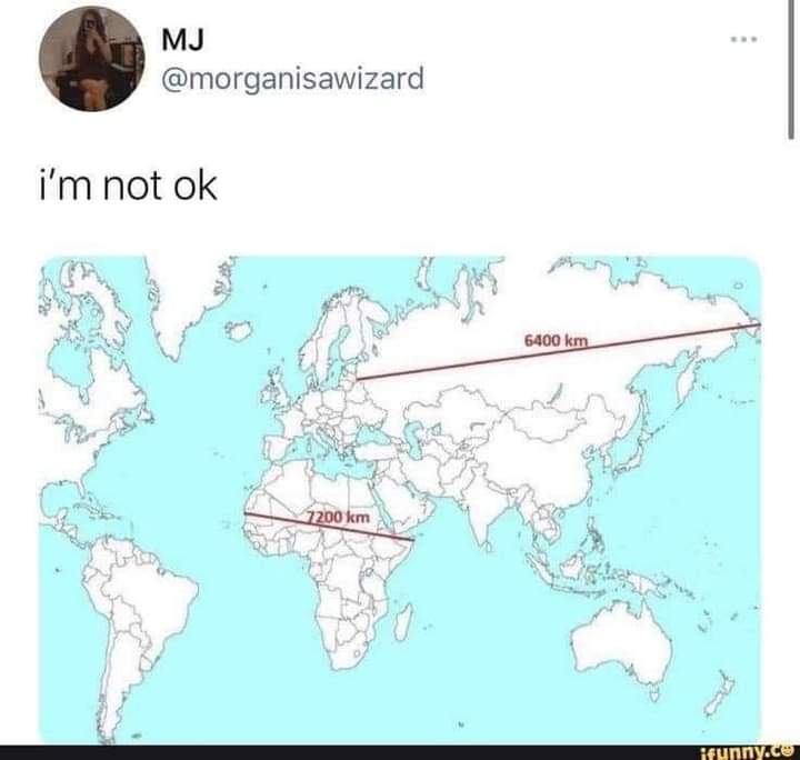
Mercator Projection. So many ways to try to represent a sphere on a flat 2D plane but none are perfect
https://theconversation.com/five-maps-that-will-change-how-you-see-the-world-74967
And this “True Size” map is fun to play with.
TheTrueSize
Dymaxion map for life!!
What Your Favorite Map Projection Says About You
That can’t be right. Nobody likes XML.
XML is fine when used in spaces it suits, though JSON is generally better
Ooh so this sent me down a Wikipedia rabbit hole and it’s so fun! I’m deciding my favorite between:
They seem intuitive without much if any distortion. Really cool stuff!
almost: i moved past toe shoes to just going barefoot a year ago, i have no 3D goggles nor a VR headset, and i use colemak
Hey, dvorak is cool
Funnily enough, I typed in Dvorak for years before I ever selected Dymaxion on that comic, but I have never viewed VR goggles in VR (my first 3d goggles were in the Pentium-1-with-small-hundreds-of-MHz-of-clock era)
I needed a Trinitron monitor to get 60hz refresh in each eye
Psh, I haven’t used Dvorak for a decade now
What Greenland actually looks like is always wild.
It looks like this massive arrow head that stretches so far to the east and west as you go north…
When really it’s just like a normal island.
And japans larger than it seems too when compared to the eastern US.
Or the sheer size of the African continent
Still pretty big though, about the same north-south as the u.s.
I mean it is a big island.
But on the standard map it looks like it’s as big as Mexico, Canada, and USA combined.
When really it’s only about 30% larger than Alaska by square km.
You undersell Alaskas sheer square milage, it is a chunky boy
Alaska is 1.7 m sq km and greenland is 2.2 m sq km. So I don’t think I’m too far off.
So greenland is a bit bigger, when it’s crazy on the map they don’t look at all to be on the same scale.
It’s even crazier for Mexico. Mexico is only a little bit smaller, but on the map it looks abysmally small in comparison.
My point is Alaska is 1/5 of the USA’s landmass. Calling Greenland a big island is underselling. If it were on its own in the Atlantic or pacific we’d argue over if it count as a dwarf continent
I’m not saying it’s not a massive island.
But just on standard maps it looks like it’s the size of Mexico, Canada, and US put together.
When it’s just a bit bigger than Mexico.
Damn I didn’t realise New Zealand is a fair bit larger than the UK, but only has like 7% of the population. Damn, that place must be empty.
Japan is also surprisingly huge. I always assumed Japan and the UK were similar in size, it’s like 1.6x the size, jesus.
Maps be crazy.
It’s a bummer this article pushes aside the importance of calculating bearings. Figuring bearings remains a required skill in both sea and air navigation. GPS works very well, but you don’t want to depend entirely upon it when there’s life and property at risk. Sextants, chronographs, and navigational maps remain onboard many ships.
To not be so negative, here’s something interesting the article does raise but didn’t mention: azimuthal maps are regularly projected at any place on earth. Azimithual projected at a radio station this makes pointing directional antennas intuitive and fast. It’s also helpful in grasping how a directional antenna will behave as their radiation patterns are drawn in polar coordinates and hence can be drawn on top of an azimithual map.
It’s possible to project a sphere perfectly onto flat 2d space if you just take one single point out. You just need an infinitely big plane